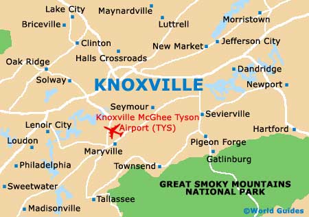
Knoxville McGhee Tyson Airport (TYS)
Orientation and Maps
(Knoxville, Tennessee (TN), USA)
The state's third-biggest city, Knoxville is the county seat and home to the University of Tennessee. One of the region's most historic cities, Knoxville has a population of around 180,000 and features more than 30 distinct neighborhoods.
To the south, Knoxville's McGhee Tyson Airport (TYS) serves the region well and is easy to reach along the US-35 and other major roads. Knoxville stands at the crossroads of both the Interstate 75 and the Interstate 40, and is approximately 175 miles / 280 km to the east of Nashville. Regular Greyhound buses link many parts of the city and the main bus station is situated along Magnolia Avenue. Many additional buses travel further afield, to destinations such as Atlanta and Chattanooga.
Knoxville McGhee Tyson Airport (TYS) Maps: Important City Districts
On the southern side of the city, the Tennessee River winds part many places of interest. Highlights along this route include the Island Home Downtown Airport, the Island Home Park, the Mcherter Riverside Landing and the university campus. The river is edged by the Neyland Drive along much of its journey. Located next to the university is the Neyland Stadium, with this area being dominated by the eye-catching Sunsphere, which was part of the city's successful World Fair in 1982.
Important districts around the city of Knoxville include the Fountain City area - close to the Interstate 640, Fourth and Gill - known for its historic appeal, and the Old City area - where you will find many top entertainment venues and local restaurants. One of Knoxville's oldest districts is Sequoyah Hills, which incorporates a number of parks, while Oakwood Lincoln Park is home to a particularly friendly community, next to Woodland Avenue.
USA Map

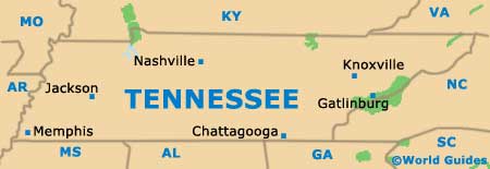
Tennessee Map
Knoxville Map